
Saint Lawrence topographic map
Interactive map
Click on the map to display elevation.
About this map
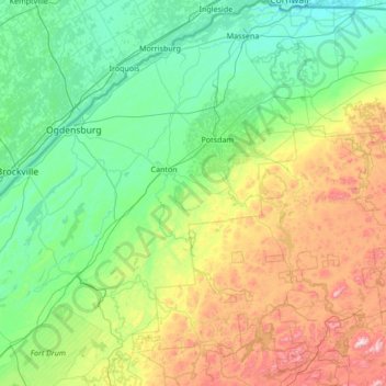
Name: Saint Lawrence topographic map, elevation, terrain.
Location: Saint Lawrence, New York, United States of America (44.05040 -75.86164 45.01586 -74.52526)
Average elevation: 239 m
Minimum elevation: 44 m
Maximum elevation: 929 m
Other topographic maps
Click on a map to view its topography, its elevation and its terrain.
Ithaca
United States of America > New York > Ithaca
Ithaca, Ithaca Town, Tompkins County, New York, United States of America
Average elevation: 194 m
Queens
United States of America > New York > New York
Queens, New York, United States of America
Average elevation: 11 m
New York County
United States of America > New York > New York
Manhattan, New York County, New York, United States of America
Average elevation: 17 m
Allegany County
United States of America > New York
Allegany County, New York, United States of America
Average elevation: 561 m
Farmingville
United States of America > New York > Farmingville
Farmingville, Suffolk, New York, 11738, United States of America
Average elevation: 47 m