
Dronten topographic map
Interactive map
Click on the map to display elevation.
About this map
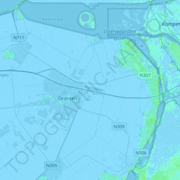
Name: Dronten topographic map, elevation, terrain.
Location: Dronten, Flevoland, Niederlande (52.45522 5.58806 52.60770 5.86450)
Average elevation: -2 m
Minimum elevation: -7 m
Maximum elevation: 12 m
Other topographic maps
Click on a map to view its topography, its elevation and its terrain.
Swifterbant
Niederlande > Flevoland > Dronten
Swifterbant, Dronten, Flevoland, Niederlande
Average elevation: -3 m