
Thank you for supporting this site ❤️
Make a donation
Make a donation
Al-Fashir topographic map
Click on the map to display elevation.
Thank you for supporting this site ❤️
Make a donation
Make a donation
About this map
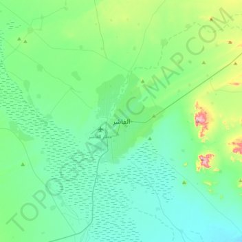
Name: Al-Fashir topographic map, elevation, terrain.
Location: Al-Fashir, Al Fasher, North Darfur State, Sudan (13.46382 25.19556 13.78382 25.51556)
Average elevation: 753 m
Minimum elevation: 684 m
Maximum elevation: 1,059 m
Thank you for supporting this site ❤️
Make a donation
Make a donation