
Thank you for supporting this site ❤️
Make a donation
Make a donation
Ertevannet topographic map
Click on the map to display elevation.
Thank you for supporting this site ❤️
Make a donation
Make a donation
About this map
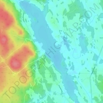
Name: Ertevannet topographic map, elevation, terrain.
Location: Ertevannet, Rakkestad, Østfold, Norway (59.30673 11.37112 59.33532 11.40159)
Average elevation: 123 m
Minimum elevation: 101 m
Maximum elevation: 179 m
Thank you for supporting this site ❤️
Make a donation
Make a donation
Other topographic maps
Click on a map to view its topography, its elevation and its terrain.
Thank you for supporting this site ❤️
Make a donation
Make a donation
Thank you for supporting this site ❤️
Make a donation
Make a donation