
Make a donation
Picnic Point topographic map
Click on the map to display elevation.
Make a donation
Picnic Point
The first addition to the Picnic Point Reserve was made when the Municipal Council purchased two freehold allotments fronting both Heller and Rowbotham Streets in 1902. By 1906 the council had commenced tree-planting at Picnic Point under the supervision of Curator Harding of the Botanical gardens. A further expansion of the reserve was made in 1909. This resulted in a considerable flow of correspondence between the Toowoomba Town Council and the Lands Department concerning the boundaries of the addition as the initial gazettal had omitted to include a "bluff point" along the northern brow of Picnic Point. This was rectified in 1910 and the whole of portion 364 and parts (the brow of the bluff) of Portions 365 and 366 were now included in the Picnic Point Reserve. Also in 1910 the Picnic Point reserve was proclaimed as a "Reserve for the Protection and Preservation of Native Birds" under "The Native Birds Protection Acts 1877 to 1884" and a proclamation dated the 25 October 1905. Alexander Holtze writing in a commemorative publication to celebrate the jubilee of the establishment of the town of Toowoomba in 1910 commented, " There are numerous picturesque spots surrounding Toowoomba, notably Picnic Point, situated at an elevation of 2,300 feet - where there is a recreation reserve of 32 acres and from which wonderful panoramas of mountain and valley scenes are visible. This point of vantage is reached from the city by a drive through tree-clad avenues, which in a few years will form a noble thoroughfare."
Make a donation
About this map
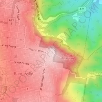
Name: Picnic Point topographic map, elevation, terrain.
Average elevation: 575 m
Minimum elevation: 346 m
Maximum elevation: 714 m
Make a donation
Other topographic maps
Click on a map to view its topography, its elevation and its terrain.