
Thank you for supporting this site ❤️
Make a donation
Make a donation
Randudongkal topographic map
Click on the map to display elevation.
Thank you for supporting this site ❤️
Make a donation
Make a donation
About this map
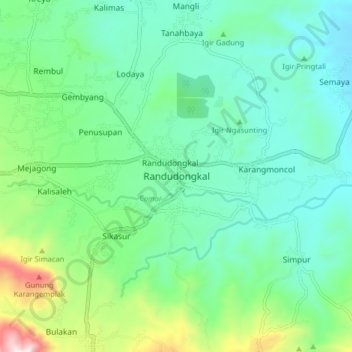
Name: Randudongkal topographic map, elevation, terrain.
Location: Randudongkal, Pemalang, Central Java, Java, Indonesia (-7.14291 109.28508 -7.06291 109.36508)
Average elevation: 245 m
Minimum elevation: 88 m
Maximum elevation: 740 m
Thank you for supporting this site ❤️
Make a donation
Make a donation