
Citamiang topographic map
Click on the map to display elevation.
About this map
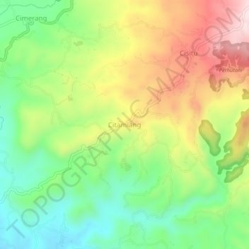
Name: Citamiang topographic map, elevation, terrain.
Location: Citamiang, Sukabumi, West Java, Java, Indonesia (-7.09264 106.88710 -7.05264 106.92710)
Average elevation: 709 m
Minimum elevation: 533 m
Maximum elevation: 944 m
Other topographic maps
Click on a map to view its topography, its elevation and its terrain.
Mount Gede Pangrango National Park
Indonesia > West Java > Sukabumi > Kadudampit
Average elevation: 1,055 m