
Hammam Righa topographic map
Interactive map
Click on the map to display elevation.
About this map
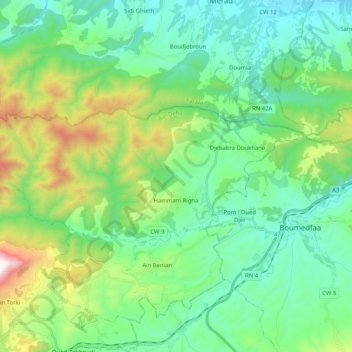
Name: Hammam Righa topographic map, elevation, terrain.
Location: Hammam Righa, Daïra Hammam Righa, Aïn Defla, RADP (36.36135 2.27181 36.42683 2.47648)
Average elevation: 450 m
Minimum elevation: 125 m
Maximum elevation: 1,419 m