
Thank you for supporting this site ❤️
Make a donation
Make a donation
Poughkeepsie topographic map
Click on the map to display elevation.
Thank you for supporting this site ❤️
Make a donation
Make a donation
About this map
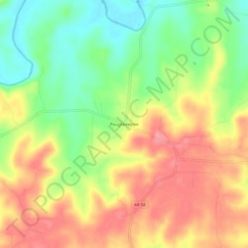
Name: Poughkeepsie topographic map, elevation, terrain.
Location: Poughkeepsie, Sharp County, Arkansas, 72569, United States (36.05674 -91.49930 36.09674 -91.45930)
Average elevation: 143 m
Minimum elevation: 96 m
Maximum elevation: 186 m
Thank you for supporting this site ❤️
Make a donation
Make a donation
Other topographic maps
Click on a map to view its topography, its elevation and its terrain.
Thank you for supporting this site ❤️
Make a donation
Make a donation
Thank you for supporting this site ❤️
Make a donation
Make a donation