
Thank you for supporting this site ❤️
Make a donation
Make a donation
Male topographic map
Click on the map to display elevation.
Thank you for supporting this site ❤️
Make a donation
Make a donation
About this map
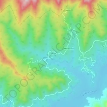
Name: Male topographic map, elevation, terrain.
Location: Male, Bhor, Pune District, Maharashtra, India (18.19641 73.67622 18.23641 73.71622)
Average elevation: 731 m
Minimum elevation: 607 m
Maximum elevation: 1,009 m
Thank you for supporting this site ❤️
Make a donation
Make a donation
Other topographic maps
Click on a map to view its topography, its elevation and its terrain.