
Make a donation
Mustang topographic map
Click on the map to display elevation.
Make a donation
About this map
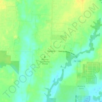
Name: Mustang topographic map, elevation, terrain.
Location: Mustang, Denton County, Texas, United States (33.30067 -96.92306 33.34067 -96.88306)
Average elevation: 182 m
Minimum elevation: 170 m
Maximum elevation: 194 m
Make a donation
Other topographic maps
Click on a map to view its topography, its elevation and its terrain.
Denton
United States > Texas > Denton County
Denton is on the northern edge of the Dallas–Fort Worth metropolitan area. These three cities form the area known as the "Golden Triangle of North Texas". According to the United States Census Bureau, the city has an area of 89.316 square miles (231.33 km2), of which 87.952 square miles (227.79 km2) is land…
Average elevation: 195 m
Lewisville
United States > Texas > Denton County
Lewisville is at 33°2′18″N 97°0′22″W / 33.03833°N 97.00611°W / 33.03833; -97.00611 (33.038316, −97.006232) at an elevation of about 550 feet (170 m). It has a total area of 42.5 square miles (110 km2), of which 6.1 sq mi (16 km2) is covered by water. It lies at the southern end of Denton…
Average elevation: 160 m
Make a donation
Clear Creek Natural Heritage Center
United States > Texas > Denton County > Denton
Average elevation: 173 m
Make a donation
Make a donation
Make a donation
Make a donation
Little Elm
United States > Texas > Denton County
According to the U.S. Census Bureau, it has a total area of 18.6 square miles (48.3 km2), of which 14.6 square miles (37.7 km2) is land and 4.1 square miles (10.5 km2), or 21.83%, is covered by water. Little Elm has an average elevation of 545 feet above sea level.
Average elevation: 171 m
Make a donation
Grapevine Lake
United States > Texas > Denton County > Grapevine > Flower Mound
Average elevation: 181 m
Make a donation
Make a donation
Denton
United States > Texas > Denton County
Denton is located on the northern edge of the Dallas–Fort Worth metropolitan area. These three cities form the area known as the "Golden Triangle of North Texas." According to the United States Census Bureau, the city has a total area of 89.316 square miles (231.33 km2), of which 87.952 square miles (227.79…
Average elevation: 195 m
Make a donation
Make a donation
Make a donation