
Thank you for supporting this site ❤️
Make a donation
Make a donation
Mae Klang Luang topographic map
Click on the map to display elevation.
Thank you for supporting this site ❤️
Make a donation
Make a donation
About this map
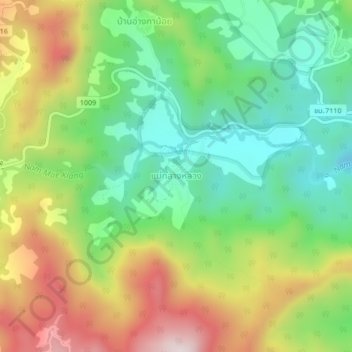
Name: Mae Klang Luang topographic map, elevation, terrain.
Location: Mae Klang Luang, Chom Thong, Chiang Mai Province, Thailand (18.51740 98.52601 18.55740 98.56601)
Average elevation: 1,211 m
Minimum elevation: 957 m
Maximum elevation: 1,588 m
Thank you for supporting this site ❤️
Make a donation
Make a donation