
Thank you for supporting this site ❤️
Make a donation
Make a donation
Garashi topographic map
Click on the map to display elevation.
Thank you for supporting this site ❤️
Make a donation
Make a donation
About this map
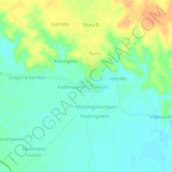
Name: Garashi topographic map, elevation, terrain.
Location: Garashi, Garashi ward, Magarini, Contea di Kilifi, Kenya (-3.15104 39.86938 -3.11104 39.90938)
Average elevation: 44 m
Minimum elevation: 31 m
Maximum elevation: 66 m
Thank you for supporting this site ❤️
Make a donation
Make a donation