
Sidan topographic map
Click on the map to display elevation.
About this map
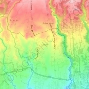
Name: Sidan topographic map, elevation, terrain.
Location: Sidan, Gianyar, Bali, Lesser Sunda Islands, 80614, Indonesia (-8.54823 115.33147 -8.50823 115.37147)
Average elevation: 157 m
Minimum elevation: 54 m
Maximum elevation: 253 m
Other topographic maps
Click on a map to view its topography, its elevation and its terrain.