
Overveen topographic map
Interactive map
Click on the map to display elevation.
About this map
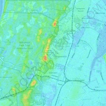
Name: Overveen topographic map, elevation, terrain.
Location: Overveen, Bloemendaal, Nordholland, Niederlande (52.37228 4.52605 52.43930 4.62394)
Average elevation: 6 m
Minimum elevation: -3 m
Maximum elevation: 40 m
Other topographic maps
Click on a map to view its topography, its elevation and its terrain.
Aerdenhout
Niederlande > Nordholland > Bloemendaal
Aerdenhout, Bloemendaal, Nordholland, Niederlande
Average elevation: 6 m