
Thank you for supporting this site ❤️
Make a donation
Make a donation
Nkawkaw topographic map
Click on the map to display elevation.
Thank you for supporting this site ❤️
Make a donation
Make a donation
About this map
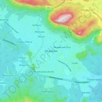
Name: Nkawkaw topographic map, elevation, terrain.
Location: Nkawkaw, Kwahu West Municipal District, Eastern Region, Ghana (6.51280 -0.80981 6.59280 -0.72981)
Average elevation: 303 m
Minimum elevation: 192 m
Maximum elevation: 768 m
Thank you for supporting this site ❤️
Make a donation
Make a donation