
Thank you for supporting this site ❤️
Make a donation
Make a donation
Neumünster topographic map
Click on the map to display elevation.
Thank you for supporting this site ❤️
Make a donation
Make a donation
Neumünster
1871 wurde die Holstenschule als Privatschule für Jungen aus dem höheren Bürgerstand gegründet. Auch die Gründung der Privaten Höheren Mädchenschule, die heute Klaus-Groth-Schule Neumünster heißt und seit 1925 staatlich ist, fiel in diese Zeit.
Thank you for supporting this site ❤️
Make a donation
Make a donation
About this map
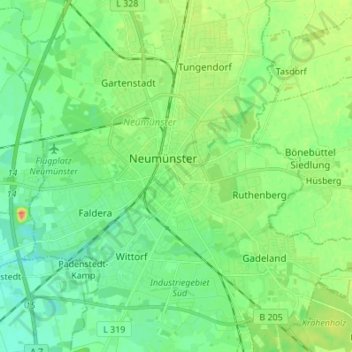
Name: Neumünster topographic map, elevation, terrain.
Location: Neumünster, Schleswig-Holstein, 24534, Deutschland (54.03574 9.94154 54.11574 10.02154)
Average elevation: 25 m
Minimum elevation: 11 m
Maximum elevation: 50 m
Thank you for supporting this site ❤️
Make a donation
Make a donation
Other topographic maps
Click on a map to view its topography, its elevation and its terrain.