
Bizerte topographic map
Interactive map
Click on the map to display elevation.
About this map
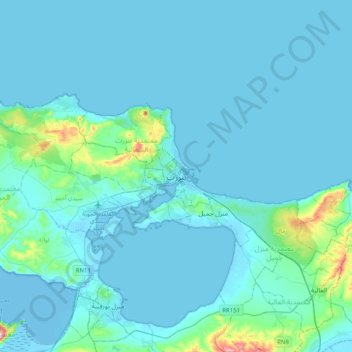
Name: Bizerte topographic map, elevation, terrain.
Average elevation: 28 m
Minimum elevation: -6 m
Maximum elevation: 386 m
The bridge leads to the motorway A4 leading to Tunis–Carthage International Airport and the capital. On the town side the P11 passes semi-rural Louata, hugs Ichkeul Lake and branches into a western route, the P7, leading directly to Tabarka on the coast next to the Algerian border. The P11 leads south-west to Béja, a governorate center, in the foothills of the Tell Atlas, forks into several roads at Bou Salem, a small town in a broad fertile plain, and climbs to Firnanah passing two high-altitude lakes and also approaching the north-west border with Algeria.