
Vinita topographic map
Interactive map
Click on the map to display elevation.
About this map
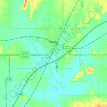
Name: Vinita topographic map, elevation, terrain.
Location: Vinita, Craig County, Oklahoma, 74301, United States (36.58978 -95.26966 36.66675 -95.12560)
Average elevation: 213 m
Minimum elevation: 200 m
Maximum elevation: 259 m
Vinita is located in northeastern Oklahoma, a region of the state known as Green Country. According to the Vinita Chamber of Commerce, the town is often called the "Crossroads to Green Country." It sits at the base of the Ozark Highlands topographical region in a mix of prairie and forest. It is located in southern Craig County.