
Thank you for supporting this site ❤️
Make a donation
Make a donation
Yantley topographic map
Click on the map to display elevation.
Thank you for supporting this site ❤️
Make a donation
Make a donation
About this map
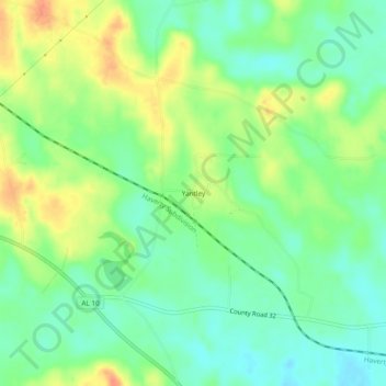
Name: Yantley topographic map, elevation, terrain.
Location: Yantley, Choctaw County, Alabama, United States (32.22598 -88.39948 32.26598 -88.35948)
Average elevation: 76 m
Minimum elevation: 57 m
Maximum elevation: 103 m
Thank you for supporting this site ❤️
Make a donation
Make a donation
Other topographic maps
Click on a map to view its topography, its elevation and its terrain.