
Thank you for supporting this site ❤️
Make a donation
Make a donation
Kourou topographic map
Click on the map to display elevation.
Thank you for supporting this site ❤️
Make a donation
Make a donation
About this map
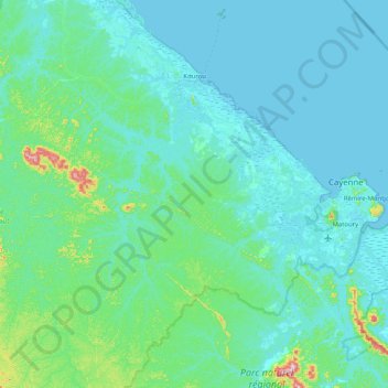
Name: Kourou topographic map, elevation, terrain.
Location: Kourou, Cayenne, French Guiana, 97310, France (4.50600 -52.98148 5.31586 -52.56129)
Average elevation: 35 m
Minimum elevation: -2 m
Maximum elevation: 387 m
Thank you for supporting this site ❤️
Make a donation
Make a donation
Other topographic maps
Click on a map to view its topography, its elevation and its terrain.
Thank you for supporting this site ❤️
Make a donation
Make a donation
Thank you for supporting this site ❤️
Make a donation
Make a donation
Saint-Laurent-du-Maroni
France > French Guiana > Saint-Laurent-du-Maroni > Saint-Laurent-du-Maroni
Average elevation: 9 m