
Thank you for supporting this site ❤️
Make a donation
Make a donation
Madera topographic map
Click on the map to display elevation.
Thank you for supporting this site ❤️
Make a donation
Make a donation
About this map
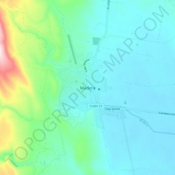
Name: Madera topographic map, elevation, terrain.
Location: Madera, Chihuahua, México (29.15340 -108.18455 29.23340 -108.10455)
Average elevation: 2,169 m
Minimum elevation: 2,081 m
Maximum elevation: 2,557 m
Thank you for supporting this site ❤️
Make a donation
Make a donation