
La Mesa topographic map
Interactive map
Click on the map to display elevation.
About this map
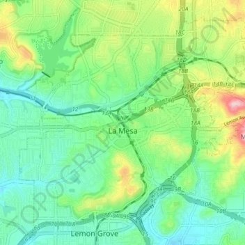
Name: La Mesa topographic map, elevation, terrain.
Location: La Mesa, San Diego County, California, USA (32.74315 -117.05376 32.79654 -116.98184)
Average elevation: 171 m
Minimum elevation: 104 m
Maximum elevation: 325 m