
Thank you for supporting this site ❤️
Make a donation
Make a donation
Gibberyd topographic map
Click on the map to display elevation.
Thank you for supporting this site ❤️
Make a donation
Make a donation
About this map
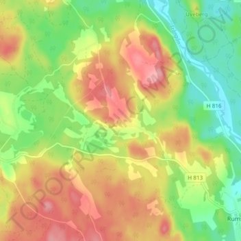
Name: Gibberyd topographic map, elevation, terrain.
Location: Gibberyd, Vimmerby kommun, Kalmar län, Zweden (57.67138 15.53427 57.71138 15.57427)
Average elevation: 176 m
Minimum elevation: 123 m
Maximum elevation: 231 m
Thank you for supporting this site ❤️
Make a donation
Make a donation
Other topographic maps
Click on a map to view its topography, its elevation and its terrain.