
Thank you for supporting this site ❤️
Make a donation
Make a donation
Atibie topographic map
Click on the map to display elevation.
Thank you for supporting this site ❤️
Make a donation
Make a donation
About this map
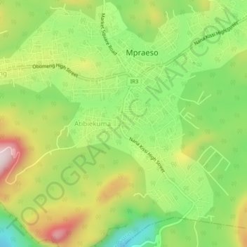
Name: Atibie topographic map, elevation, terrain.
Location: Atibie, Kwahu South District, Eastern Region, Ghana (6.56509 -0.75645 6.60509 -0.71645)
Average elevation: 494 m
Minimum elevation: 290 m
Maximum elevation: 753 m
Thank you for supporting this site ❤️
Make a donation
Make a donation