
Sanur topographic map
Interactive map
Click on the map to display elevation.
About this map
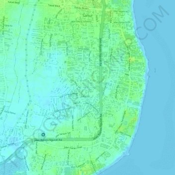
Name: Sanur topographic map, elevation, terrain.
Location: Sanur, Denpasar Selatan, Denpasar, Bali, Indonesië (-8.71033 115.25246 -8.68057 115.26715)
Average elevation: 4 m
Minimum elevation: -1 m
Maximum elevation: 12 m
Other topographic maps
Click on a map to view its topography, its elevation and its terrain.
Sanur Kauh
Indonesië > Bali > Denpasar > Sanur Kauh
Sanur Kauh, Denpasar Selatan, Denpasar, Bali, 80227, Indonesië
Average elevation: 4 m