
Thank you for supporting this site ❤️
Make a donation
Make a donation
Eggleston topographic map
Click on the map to display elevation.
Thank you for supporting this site ❤️
Make a donation
Make a donation
Eggleston
It lies at an elevation of 1,821 feet.
Thank you for supporting this site ❤️
Make a donation
Make a donation
About this map
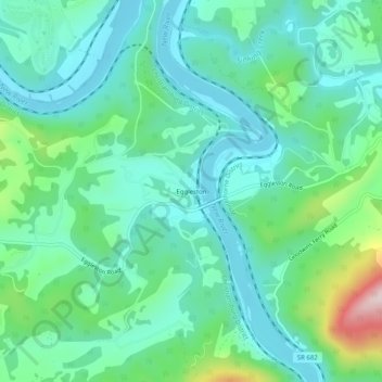
Name: Eggleston topographic map, elevation, terrain.
Location: Eggleston, Giles County, Virginia, 24086, United States (37.26735 -80.63867 37.30735 -80.59867)
Average elevation: 572 m
Minimum elevation: 483 m
Maximum elevation: 871 m
Thank you for supporting this site ❤️
Make a donation
Make a donation
Other topographic maps
Click on a map to view its topography, its elevation and its terrain.