
Thank you for supporting this site ❤️
Make a donation
Make a donation
Sugar Grove topographic map
Click on the map to display elevation.
Thank you for supporting this site ❤️
Make a donation
Make a donation
About this map
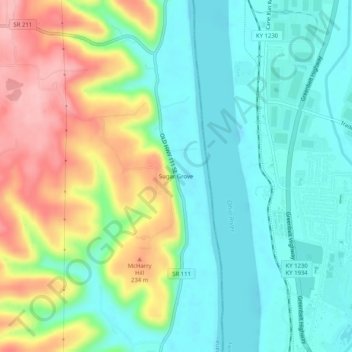
Name: Sugar Grove topographic map, elevation, terrain.
Location: Sugar Grove, Harrison County, Indiana, United States (38.09785 -85.93108 38.13785 -85.89108)
Average elevation: 171 m
Minimum elevation: 122 m
Maximum elevation: 266 m
Thank you for supporting this site ❤️
Make a donation
Make a donation
Other topographic maps
Click on a map to view its topography, its elevation and its terrain.