
Thank you for supporting this site ❤️
Make a donation
Make a donation
West Pangburn topographic map
Click on the map to display elevation.
Thank you for supporting this site ❤️
Make a donation
Make a donation
About this map
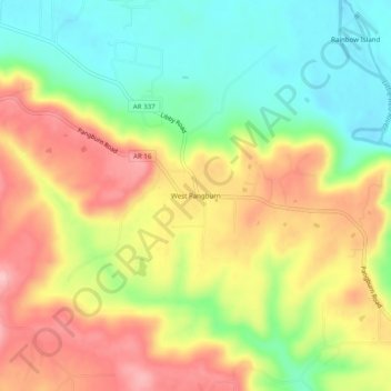
Name: West Pangburn topographic map, elevation, terrain.
Location: West Pangburn, Cleburne County, Arkansas, United States (35.41186 -91.90688 35.45186 -91.86688)
Average elevation: 142 m
Minimum elevation: 71 m
Maximum elevation: 218 m
Thank you for supporting this site ❤️
Make a donation
Make a donation
Other topographic maps
Click on a map to view its topography, its elevation and its terrain.