
Untergiblen topographic map
Interactive map
Click on the map to display elevation.
About this map
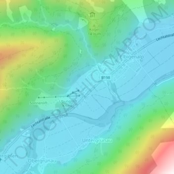
Name: Untergiblen topographic map, elevation, terrain.
Location: Untergiblen, Elbigenalp, Bezirk Reutte, Autriche (47.28271 10.42370 47.28977 10.43132)
Average elevation: 1,233 m
Minimum elevation: 1,028 m
Maximum elevation: 1,963 m
Other topographic maps
Click on a map to view its topography, its elevation and its terrain.
Bschlabs
Autriche > Bezirk Reutte > Pfafflar
Bschlabs, Pfafflar, Bezirk Reutte, 6647, Autriche
Average elevation: 1,668 m
Forchach
Forchach, Bezirk Reutte, Tyrol, 6670, Autriche
Average elevation: 1,325 m