
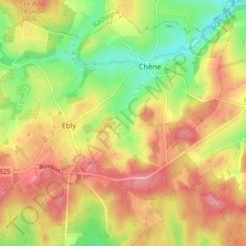
Vaux-lez-Chêne topographic map
Interactive map
Click on the map to display elevation.
About this map
Name: Vaux-lez-Chêne topographic map, elevation, terrain.
Average elevation: 470 m
Minimum elevation: 415 m
Maximum elevation: 517 m
Other topographic maps
Click on a map to view its topography, its elevation and its terrain.
Ebly
Belgique > Luxembourg > Neufchâteau > Ebly
Ebly, Léglise, Neufchâteau, Luxembourg, Wallonie, Belgique
Average elevation: 470 m
Maisoncelle
Belgique > Luxembourg > Neufchâteau > Ebly > Maisoncelle
Maisoncelle, Ebly, Léglise, Neufchâteau, Luxembourg, Wallonie, 6642, Belgique
Average elevation: 474 m