
Taher topographic map
Interactive map
Click on the map to display elevation.
About this map
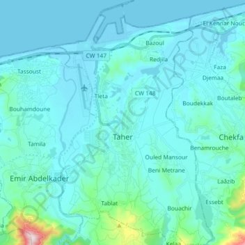
Name: Taher topographic map, elevation, terrain.
Location: Taher, daïra Taher, Jijel, RADP (36.72052 5.85757 36.83557 5.95109)
Average elevation: 57 m
Minimum elevation: -2 m
Maximum elevation: 622 m