
Lünen topographic map
Interactive map
Click on the map to display elevation.
About this map
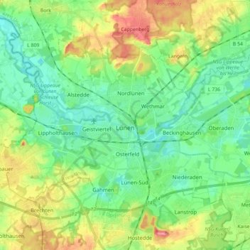
Name: Lünen topographic map, elevation, terrain.
Location: Lünen, Kreis Unna, Rhénanie-du-Nord-Westphalie, Allemagne (51.57802 7.41788 51.65267 7.59233)
Average elevation: 68 m
Minimum elevation: 41 m
Maximum elevation: 120 m
Other topographic maps
Click on a map to view its topography, its elevation and its terrain.
Kamen
Allemagne > Rhénanie-du-Nord-Westphalie > Kreis Unna
Kamen, Kreis Unna, Rhénanie-du-Nord-Westphalie, 59174, Allemagne
Average elevation: 71 m