
Nankin topographic map
Interactive map
Click on the map to display elevation.
About this map
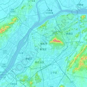
Name: Nankin topographic map, elevation, terrain.
Location: Nankin, Jiangsu, 210005, Chine (31.88377 118.61887 32.20377 118.93887)
Average elevation: 25 m
Minimum elevation: 0 m
Maximum elevation: 430 m
Other topographic maps
Click on a map to view its topography, its elevation and its terrain.