
Thank you for supporting this site ❤️
Make a donation
Make a donation
Alcona Township topographic map
Click on the map to display elevation.
Thank you for supporting this site ❤️
Make a donation
Make a donation
About this map
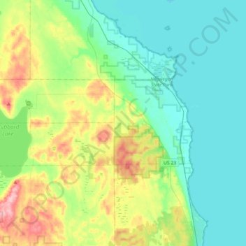
Name: Alcona Township topographic map, elevation, terrain.
Location: Alcona Township, Alcona County, Michigan, United States (44.77032 -83.64589 44.85879 -83.29085)
Average elevation: 215 m
Minimum elevation: 172 m
Maximum elevation: 336 m
Thank you for supporting this site ❤️
Make a donation
Make a donation
Other topographic maps
Click on a map to view its topography, its elevation and its terrain.