
Thank you for supporting this site ❤️
Make a donation
Make a donation
Carlton topographic map
Click on the map to display elevation.
Thank you for supporting this site ❤️
Make a donation
Make a donation
About this map
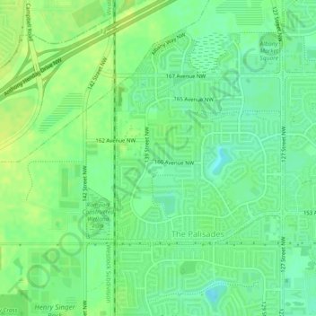
Name: Carlton topographic map, elevation, terrain.
Location: Carlton, The Palisades, Edmonton, Alberta, T6V 0C9, Canada (53.61461 -113.56521 53.62873 -113.55350)
Average elevation: 684 m
Minimum elevation: 675 m
Maximum elevation: 692 m
Thank you for supporting this site ❤️
Make a donation
Make a donation
Other topographic maps
Click on a map to view its topography, its elevation and its terrain.