
Thank you for supporting this site ❤️
Make a donation
Make a donation
Garagata topographic map
Click on the map to display elevation.
Thank you for supporting this site ❤️
Make a donation
Make a donation
About this map
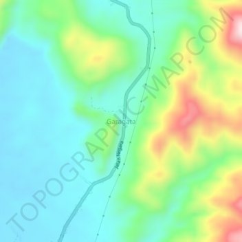
Name: Garagata topographic map, elevation, terrain.
Location: Garagata, Tabalong, Kalimantan Selatan, Indonésia (-1.82857 115.63357 -1.78857 115.67357)
Average elevation: 179 m
Minimum elevation: 62 m
Maximum elevation: 474 m
Thank you for supporting this site ❤️
Make a donation
Make a donation