
La Pola topographic map
Interactive map
Click on the map to display elevation.
About this map
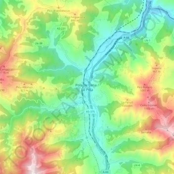
Name: La Pola topographic map, elevation, terrain.
Location: La Pola, Lena, Asturië, 33630, Spanje (43.12157 -5.86814 43.20157 -5.78814)
Average elevation: 637 m
Minimum elevation: 241 m
Maximum elevation: 1,328 m