
Mawlynnong topographic map
Interactive map
Click on the map to display elevation.
About this map
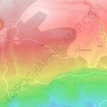
Name: Mawlynnong topographic map, elevation, terrain.
Location: Mawlynnong, Pynursla, East Khasi Hills, Meghalaya, India (25.18195 91.89551 25.22195 91.93551)
Average elevation: 425 m
Minimum elevation: 18 m
Maximum elevation: 662 m