
Thank you for supporting this site ❤️
Make a donation
Make a donation
Hillsboro topographic map
Click on the map to display elevation.
Thank you for supporting this site ❤️
Make a donation
Make a donation
About this map
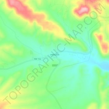
Name: Hillsboro topographic map, elevation, terrain.
Location: Hillsboro, Sierra County, New Mexico, 88042, United States (32.90091 -107.58697 32.94091 -107.54697)
Average elevation: 1,652 m
Minimum elevation: 1,573 m
Maximum elevation: 1,790 m
Thank you for supporting this site ❤️
Make a donation
Make a donation
Other topographic maps
Click on a map to view its topography, its elevation and its terrain.