
Igstadt topographic map
Interactive map
Click on the map to display elevation.
About this map
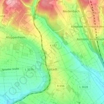
Name: Igstadt topographic map, elevation, terrain.
Location: Igstadt, Wiesbaden, Hessen, Deutschland (50.06797 8.30660 50.10916 8.35590)
Average elevation: 197 m
Minimum elevation: 149 m
Maximum elevation: 274 m
Other topographic maps
Click on a map to view its topography, its elevation and its terrain.
Wiesbaden
Deutschland > Hessen > Wiesbaden
Wiesbaden, Hessen, 15183, Deutschland
Average elevation: 258 m