
Thank you for supporting this site ❤️
Make a donation
Make a donation
Anin topographic map
Click on the map to display elevation.
Thank you for supporting this site ❤️
Make a donation
Make a donation
About this map
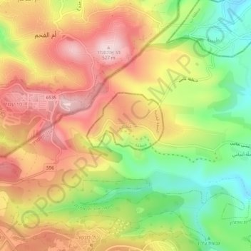
Name: Anin topographic map, elevation, terrain.
Location: Anin, Area B, West Bank, Palestinian Territories (32.48123 35.14764 32.52123 35.18764)
Average elevation: 356 m
Minimum elevation: 177 m
Maximum elevation: 518 m
Thank you for supporting this site ❤️
Make a donation
Make a donation
Other topographic maps
Click on a map to view its topography, its elevation and its terrain.