
Thank you for supporting this site ❤️
Make a donation
Make a donation
Parc des Venelles topographic map
Click on the map to display elevation.
Thank you for supporting this site ❤️
Make a donation
Make a donation
About this map
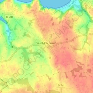
Name: Parc des Venelles topographic map, elevation, terrain.
Average elevation: 32 m
Minimum elevation: 0 m
Maximum elevation: 50 m
Thank you for supporting this site ❤️
Make a donation
Make a donation
Other topographic maps
Click on a map to view its topography, its elevation and its terrain.
Fort du Guesclin
France > Bretagne > Ille-et-Vilaine > Saint-Coulomb > La Basse Ville Énoux
Average elevation: 10 m