
Thank you for supporting this site ❤️
Make a donation
Make a donation
Fortunau (Ayent) topographic map
Click on the map to display elevation.
Thank you for supporting this site ❤️
Make a donation
Make a donation
About this map
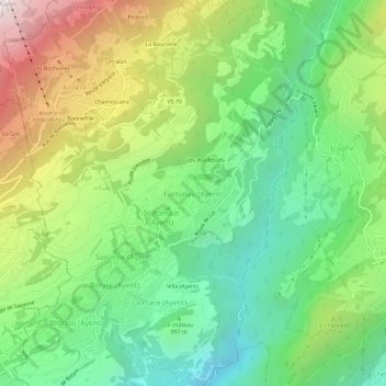
Name: Fortunau (Ayent) topographic map, elevation, terrain.
Location: Fortunau (Ayent), Ayent, Hérens, Valais, 1966, Suisse (46.26606 7.39674 46.30606 7.43674)
Average elevation: 1,116 m
Minimum elevation: 539 m
Maximum elevation: 2,095 m
Thank you for supporting this site ❤️
Make a donation
Make a donation