
Thank you for supporting this site ❤️
Make a donation
Make a donation
Muang Khong topographic map
Click on the map to display elevation.
Thank you for supporting this site ❤️
Make a donation
Make a donation
About this map
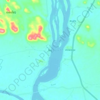
Name: Muang Khong topographic map, elevation, terrain.
Location: Muang Khong, Khong District, Champasak Province, Laos (14.07884 105.81519 14.15884 105.89519)
Average elevation: 99 m
Minimum elevation: 79 m
Maximum elevation: 227 m
Thank you for supporting this site ❤️
Make a donation
Make a donation