
Thank you for supporting this site ❤️
Make a donation
Make a donation
Kisagazi (Busaale) topographic map
Click on the map to display elevation.
Thank you for supporting this site ❤️
Make a donation
Make a donation
About this map
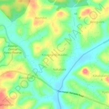
Name: Kisagazi (Busaale) topographic map, elevation, terrain.
Location: Kisagazi (Busaale), Mubende, Central Region, Uganda (0.53548 31.41150 0.57548 31.45150)
Average elevation: 1,251 m
Minimum elevation: 1,219 m
Maximum elevation: 1,301 m
Thank you for supporting this site ❤️
Make a donation
Make a donation