
Edmonston topographic map
Interactive map
Click on the map to display elevation.
About this map
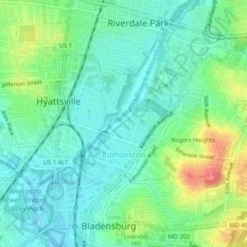
Name: Edmonston topographic map, elevation, terrain.
Average elevation: 21 m
Minimum elevation: -2 m
Maximum elevation: 69 m
Other topographic maps
Click on a map to view its topography, its elevation and its terrain.
Capitol Heights
États-Unis d'Amérique > Maryland > Prince George's County
Capitol Heights, Prince George's County, Maryland, États-Unis d'Amérique
Average elevation: 64 m