
Patti topographic map
Interactive map
Click on the map to display elevation.
About this map
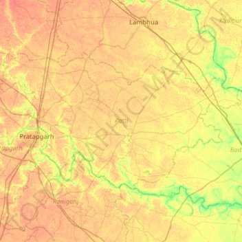
Name: Patti topographic map, elevation, terrain.
Location: Patti, Pratapgarh District, Uttar Pradesh, India (25.82079 81.92428 26.07941 82.43265)
Average elevation: 93 m
Minimum elevation: 74 m
Maximum elevation: 103 m
Other topographic maps
Click on a map to view its topography, its elevation and its terrain.
Kunda
India > Uttar Pradesh > Pratapgarh District
Kunda, Pratapgarh District, Uttar Pradesh, India
Average elevation: 102 m