
Mangahurco topographic map
Interactive map
Click on the map to display elevation.
About this map
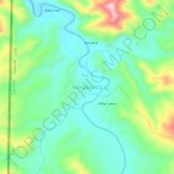
Name: Mangahurco topographic map, elevation, terrain.
Location: Mangahurco, Zapotillo, Loja, Ecuador (-4.17605 -80.45196 -4.13605 -80.41196)
Average elevation: 349 m
Minimum elevation: 272 m
Maximum elevation: 528 m