
Sollentuna kommun topographic map
Interactive map
Click on the map to display elevation.
About this map
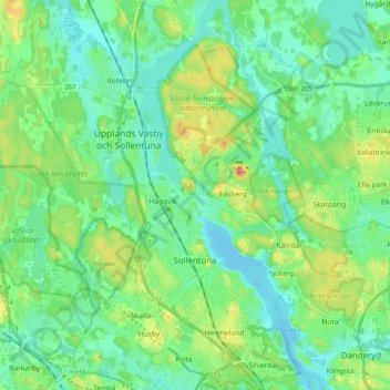
Name: Sollentuna kommun topographic map, elevation, terrain.
Location: Sollentuna kommun, Stockholm County, Sweden (59.39511 17.82430 59.49745 18.01068)
Average elevation: 24 m
Minimum elevation: -4 m
Maximum elevation: 93 m
Other topographic maps
Click on a map to view its topography, its elevation and its terrain.
Stockholm
Stockholm, Solna kommun, Stockholm County, Sweden
Average elevation: 25 m
Haninge kommun
Haninge kommun, Stockholm County, Sweden
Average elevation: 9 m
Stockholm
Stockholm, Stockholms kommun, Stockholm County, 111 29, Sweden
Average elevation: 26 m
Sigtuna
Sigtuna, Sigtuna kommun, Stockholm County, 193 35, Sweden
Average elevation: 21 m